Trail Maps and Reports
Some fantastic volunteers make it possible for all of us to enjoy miles and miles of offroad trails. Next time you’re out and see one, be sure to give them a smile and a wave!
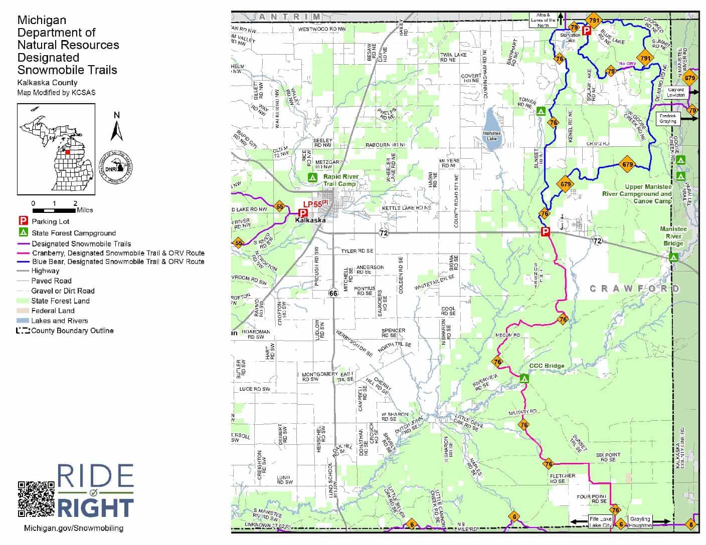
What are the Blue Bear and Cranberry Trails ?
Standing in the Trail Head Parking lot on M 72. CranberryTrail : If you go south and cross M72 then continue straight it runs until you hit the “T” going to Grayling or Fife Lake. Blue Bear Trail: If you head north into the woods. It is a loop that turns back at Starvation Lake to the M 72 parking Lot. Map on right color coded.
No Results Found
The page you requested could not be found. Try refining your search, or use the navigation above to locate the post.
Downloadable Trail Maps

Get Updates on Tracker App
Track our groomers live!
Become a Volunteer and join us!
KCSAS is a 100% volunteer run organization working together to better the trails of Kalkaska county for communities, families, and fun.

